 SRTM Terrain Importer

SRTM Terrain Importer
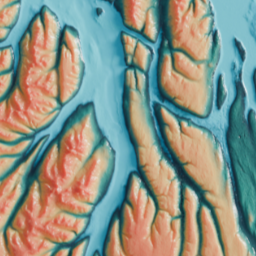
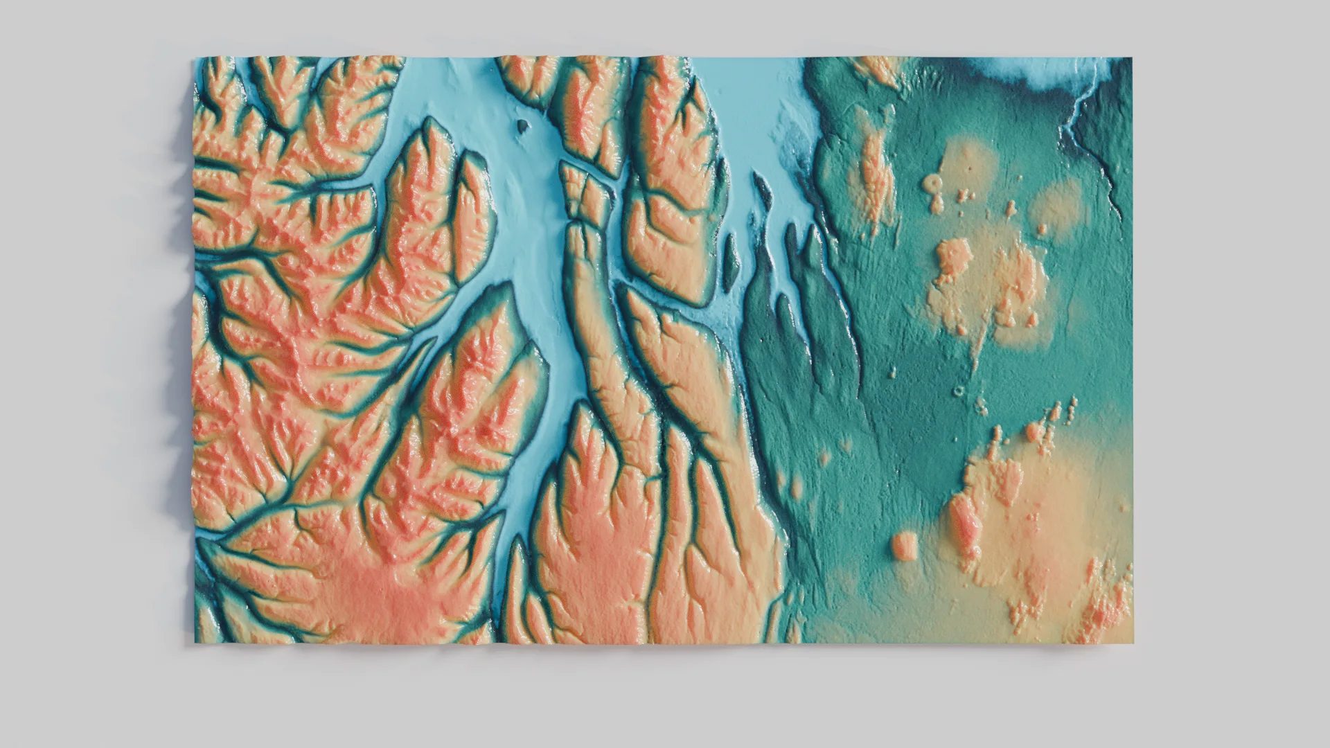
This addon imports SRTM (Shuttle Radar Topography Mission) HGT files and creates accurate 3D terrain meshes with proper real-world scaling and elevation-based materials.
What are SRTM HGT Files?
SRTM HGT files contain digital elevation data collected by NASA's Shuttle Radar Topography Mission. This mission mapped nearly the entire Earth (between 60°N and 56°S) using radar interferometry. The data is available in two resolutions:
- SRTM1 (1 arc-second, approximately 30 meters resolution)
- SRTM3 (3 arc-seconds, approximately 90 meters resolution)
Each .hgt file covers a 1° × 1° tile of terrain and is named according to its coordinates (e.g., "N37W122.hgt" covers the area at 37°N, 122°W).
Features
- Accurate Scaling: Terrain dimensions are automatically calculated based on latitude
- Real Elevation Data: Heights are preserved in real-world meters
- Smart Materials: Automatic creation of elevation-based color gradient materials
- Customizable Settings:
- Adjustable vertical scale for height exaggeration
- Controllable mesh subdivision levels
- Choice of color schemes (natural terrain or grayscale)
- Convenient Import: Supports both traditional file selection and drag-and-drop
How to Use
Importing Terrain:
- Method 1: Go to File > Import > SRTM HGT (.hgt)
- Method 2: Simply drag and drop .hgt files into Blender window
Import Options:
- Subdivisions: Control mesh detail (10-200)
- Vertical Scale: Adjust height exaggeration (0.1x - 5.0x)
- Color Scheme: Choose between natural terrain colors or grayscale elevation map
Getting SRTM Data
Visit https://dwtkns.com/srtm30m/ to browse and select terrain tiles Create a free NASA Earthdata account at https://urs.earthdata.nasa.gov/ if you don't have one Download the desired .hgt files Files are named based on their coordinates (e.g., N37W123.hgt)
Use Cases
- Landscape Visualization: Create accurate representations of real-world terrains for visualization
- Scientific Terrain Analysis: Study geographical features and elevation patterns
- Game Level Design: Use real-world terrain data as a base for game environments
- Environmental Studies: Analyze topographical features and watersheds
- Architecture Site Planning: Understand site topography for construction projects
- VFX Background Creation: Generate realistic terrain backgrounds for visual effects
Technical Details
Mesh Creation
- Generated meshes are properly scaled based on latitude
- Each vertex position corresponds to real-world coordinates
- Automatic subdivision based on user settings
- Optimized for memory usage with large terrains
Material System
- Uses Blender's node system for elevation-based coloring
- Real-world height values drive the color gradient
- Displacement for accurate height representation
- Two color schemes available:
- Natural terrain colors (default)
- Grayscale elevation map
Metadata Storage
Each created terrain object stores:
- Latitude and longitude
- Minimum and maximum elevation
- Tile width and height in meters
- Original data resolution
Performance Considerations
- Mesh density affects viewport performance
- Start with lower subdivision values (around 50)
- Increase detail as needed
- Viewport clip range automatically adjusted for large terrains
Limitations
- Limited to areas covered by SRTM (60°N to 56°S)
- Some areas may have voids or artifacts in the source data
- Very large terrains may require significant memory
- Processing time increases with subdivision level
Version History
- 1.0.0 (2025)
- Initial release
- Basic terrain import functionality
- Real-world scaling
- Elevation-based materials
- Drag and drop support
What's New
No changelog for this release.